Decades of getting around County Kerry without a car have shown me a county that is better served than its rural reputation suggests, provided that the two networks are read together. Bus Éireann provides many of the main links between the towns, while TFI Local Link Kerry serves many of the smaller places that the interurban routes do not reach, including several coastal villages. The routes covered here are all scheduled services that can be boarded without booking a seat, which keeps a spontaneous day trip simple.
The catch is that frequency varies enormously. A route on the network map does not guarantee a bus every hour or even every day, so the timetable needs checking before any day trip or linear walk. Those decades have included the train between Cork, Mallow, Killarney and Tralee, the Bus Éireann routes 13, 14, 270, 275 and 279, Local Link 280 and, at times, Dublin Coach. The sections below combine that experience with the latest timetables for the services that look most useful around Killarney, Killorglin, Tralee and North Kerry.
Killarney, Killorglin and the Iveragh Peninsula
Killarney to Killorglin
The journey between these two towns is better served than Local Link 280 alone would suggest, because Bus Éireann route 279 adds a substantial second service. It runs from Killarney through Fossa and Beaufort Bridge to Killorglin, then continues north through Milltown and Castlemaine to Tralee. Buses operate seven days a week, and from Monday to Saturday they leave Tralee between 06:00 and 23:05.
Sunday is quieter but still practical. The Sunday timetable shows eleven departures from Killarney towards Killorglin, starting at 07:35 and finishing at 21:45, with no gap longer than 1 hour 45 minutes. Even so, the date and direction deserve a check before relying on a particular bus.
At Killorglin the Local Link 280 takes a different line, continuing west through Glenbeigh, Kells and Cahersiveen to Waterville. It also calls at the post office stop in Beaufort village, whereas the 279 uses only the stop at Beaufort Bridge. That difference matters for walkers heading into the Laune valley, since the distance from the stop to the start of a route can change noticeably.
Westward from Killorglin
A further but much more limited connection comes from Bus Éireann 279A, which runs west from Killorglin through Glenbeigh and Kells to Cahersiveen. It provides one daily return service on weekdays, leaving Cahersiveen at 07:30 and returning from Tralee at 15:10. That makes it a supplement to the Local Link 280 rather than a substitute, so the 280 timetable is the better starting point for planning.
Towards Kenmare and West Cork
Bus Éireann 270 is the other useful corridor out of Killarney, running through Kenmare and Glengarriff to Bantry and Skibbereen. The timetable shows eleven departures from Killarney between 07:45 and 21:40, although not every journey runs the full length of the route. Checking where a particular bus terminates is worth the effort before committing to a walk at the far end.
Tralee and the Dingle Peninsula
The best base for the rest of the county is Tralee, because routes fan out from it in several directions. Bus Éireann 271 and 284 link it with Killarney by different roads, via Kerry Airport and via Farranfore respectively, while the services towards Dingle, Listowel, Ballybunion and Fenit all start from the same town.
Bus Éireann 275 is the main corridor to the Dingle Peninsula, running through Blennerville, Camp and Annascaul to Dingle. The timetable shows ten departures from Tralee between 06:00 and 22:00, which is generous for a rural route. Local Link 273 complements it by serving Castlegregory, Cloghane and Brandon on the northern side of the peninsula, so reading both timetables together can reveal combinations that neither shows alone.
North Kerry’s Coast and Greenways
The landscape here is gentler than the mountains of the south and west, with long beaches, dunes and estuaries in place of high ground. Tralee works well as a base for the coast, while Listowel suits Ballybunion and the Shannon Estuary. Bus Éireann and Local Link services share the work here, and they approach the coast from different directions.
Ballybunion
Two routes reach Ballybunion from Tralee. Bus Éireann 272 runs through Abbeydorney, Lixnaw, Finuge and Listowel, with five round trips daily and departures from Tralee between 09:00 and 21:15, including a Sunday service. Local Link 274 takes the coastal road through Ardfert and Ballyheigue instead, but it runs only three times a day in each direction, seven days a week.
That limited service shapes what is practical on the 274. Buses leave Tralee Denny Street between 08:55 and 17:42, while the return buses from Ballybunion run between 07:20 and 16:07, so the time in town ranges from a little over two hours to around six depending on the pairing. The evening arrival has no bus back that day. Using the 272 for the return leg changes the picture, because it leaves Ballybunion five times a day and takes the inland road through Listowel.
Ballybunion itself has two main beaches, the Ladies Beach to the north and the Men’s Beach to the south, divided by the castle ruins on the cliff top. A cliff path of about one kilometre links the two and takes around 30 minutes, while the Long Strand beyond the Men’s Beach offers a 3.2-kilometre stretch of sand for a longer shoreline walk.
Banna Strand and Ballyheigue
A long Blue Flag beach backed by dunes, Banna Strand lies about 7 kilometres north of Tralee and needs more thought to reach. According to Kerry’s car-free guide to North Kerry, the scheduled 274 stops at Banna Cross, which is an 850-metre walk of roughly 15 minutes from the beach.
Ballyheigue also lies on the 274, and the bus from Banna Cross reaches it in about 8 minutes. With only three departures a day, a beach walk between the two needs its timings worked out in advance.
Fenit and the Tralee to Fenit Greenway
The most straightforward North Kerry outing by public transport is Fenit. Local Link 278 runs seven daily return services from Monday to Sunday, with an additional evening journey on Fridays and Saturdays, and the trip takes roughly 25 to 45 minutes depending on the stops used. That spread of departures makes it far easier to choose a return time than on the north coast route.
The Tralee to Fenit Greenway follows a 13.6 kilometre off-road trail between the two places, which the same guide puts at about 3 hours 20 minutes on foot. The bus therefore gives walkers the option of travelling one way and walking the other.
Listowel, Tarbert and the Shannon Estuary
As an interchange, Listowel has Expressway 13 linking Tralee and Listowel with Abbeyfeale and Limerick, and the 272 running on to Ballybunion. It also gives access to the Kingdom of Kerry Greenways route towards the Limerick border, which Discover Ireland lists as 16 kilometres from Listowel to Abbeyfeale. Because route 13 calls at Abbeyfeale as well as Listowel, a one-way walk or cycle with a bus at the other end looks possible, provided that the chosen service times line up.
Tarbert and Ballylongford offer a different kind of excursion, with views and walks around the Shannon Estuary, but the connections are harder to arrange. The 274 reaches Tarbert between 10:41 and 19:28, and the last 274 back leaves at 15:30, so the time in the village ranges from under an hour to just under five hours. The evening arrival has no 274 back that day, although the 314 described below also calls at Tarbert and widens the choices. The woodland walk there is about 5 kilometres and takes roughly 1 hour 30 minutes.
Anyone approaching from the Limerick side has another option in Bus Éireann 314, which runs from Limerick through Foynes, Glin, Tarbert and Listowel to Ballybunion. The full journey takes a little under two and a half hours, so it suits a relaxed day out better than a quick hop. From Monday to Saturday only about half of the departures from Limerick run the whole way, while the others end at Foynes, which means the destination on the front of the bus needs checking before boarding. Sundays and public holidays are simpler, because every bus runs the full route, although there are fewer of them than on other days.
From Tarbert the Shannon Ferries crossing to Killimer takes 20 minutes and lands in County Clare. Onward public transport on the Clare side would need researching separately.
Trains and Long-Distance Coaches Into Kerry
The Cork to Tralee Railway
Rail covers the county’s spine better than many visitors expect, because the Mallow to Tralee line runs for 99 kilometres through Banteer, Millstreet, Rathmore, Killarney and Farranfore to Tralee Casement Station. Trains from Cork and Dublin use it, and the current timetable shows a service roughly every two hours. Cork to Tralee takes around two and a half hours, while Killarney to Tralee takes roughly 40 minutes.
Killarney station is a dead end, so trains continuing to Tralee reverse there before heading west again. That quirk is easy to overlook when comparing journey times with the buses, which take the road directly between the two towns. Farranfore deserves a note for walkers and airport travellers, since the station lies about 1.6 kilometres from Kerry Airport.
Limerick Services and Dublin Coach
Bus Éireann 14 shares the Limerick corridor with the 13 as far as Abbeyfeale, then turns for Kerry Airport and Killarney while the 13 carries on to Tralee. Between Limerick and Abbeyfeale the two routes together offer 11 services in each direction from Monday to Saturday, with more on Sundays and public holidays. That pairing makes Limerick a practical gateway to Kerry for anyone arriving from the Shannon side.
The Dublin Coach M7 Express adds a private operator to the choice, running daily between Dublin, Limerick and Kerry. Departures run from the early hours until the evening, with Killarney, Farranfore and Tralee all served, and the buses leave Tralee and Killarney at different times. That spread helps with early starts and late connections, although the stops are at Princes Street in Tralee and Mission Road in Killarney, which can differ from the Bus Éireann and railway stations.
A second private operator, Flight Link, runs its 722 coach between Killarney and Dublin Airport through Farranfore, Abbeyfeale, Newcastle West, Adare and Limerick. The timetable shows several departures from Killarney every day, including overnight, and the full run to the airport takes about four hours.
Choosing a County Kerry Outing Without a Car
Taken together, the services form a network that rewards anyone willing to read two or three timetables side by side. Around Killarney and Killorglin the 279 and the Local Link 280 overlap usefully, the 270 reaches towards West Cork, and the train and long-distance coaches bring travellers to the same towns from Cork, Limerick and Dublin.
Tralee remains the best base for the rest of the county, with the 275 and 273 serving the Dingle Peninsula while the 272, 274 and 278 head for Ballybunion, the north coast and Fenit. Fenit and the Dingle corridor offer the most generous choice of return times, whereas Banna Strand, Ballyheigue and Tarbert need the most planning because the buses are infrequent and the walk from the stop adds time. Reaching remote mountain trailheads remains the weak point of the network, so the official timetables stay the final word, since frequencies, directions and operating days differ from route to route.
County Mayo has a reasonably useful public transport network by the standards of the west of Ireland, though services are spread unevenly across a large and varied landscape. The main towns are linked by rail and by Bus Éireann services, while many of the more remote coastal and upland areas rely on TFI Local Link Mayo.
The central difficulty is rarely reaching a town or station. What matters more is whether a bus can then take you to a trailhead and, just as importantly, bring you back before dark.
Rail Connections
The railway enters Mayo from the east and runs across the middle of the county to Westport on Clew Bay. Trains on the Dublin Heuston to Westport and Ballina route run through Athlone and Roscommon to Ballyhaunis, Claremorris, Castlebar and Westport, and Westport has several direct trains to and from Dublin each day. Ballina lies on a branch of about 33 km that leaves the main line at Manulla Junction, where you change trains for Foxford and Ballina.
Beyond Westport and Ballina, the rail network does not go any further. There is no train to Achill, Belmullet, Louisburgh or Newport, so reaching those places means continuing by bus, and the connecting service often decides whether a day trip is practical.
Buses and Coaches
Bus Éireann runs most of the regional corridors, and Transport for Ireland publishes the full list of routes. Castlebar, Pontoon and Ballina are linked by route 420, while route 423 runs from Westport to Clifden by way of Leenane and Kylemore. In the north, route 445 serves Ballina, Killala and Ballycastle, and route 446 continues from Ballina through Belmullet to Blacksod. Further afield, route 440 connects Westport with Athlone and route 458 links Ballina with Sligo and Enniskillen.
In the west, route 450 runs from Dooagh on Achill through Keel, Achill Sound, Mulranny and Newport to Westport. It then continues to Murrisk and Louisburgh, which makes it the most useful single route for the western side of the county.
The other important corridor is route 456, which runs from Castlebar through Westport, Ballinrobe, Kilmaine and Headford to Galway. Departures from Castlebar towards Galway run roughly every three hours from early morning to evening, which makes it the most frequent service of its kind in the county.
Local Link in the West
TFI Local Link Mayo runs Regular Rural Services on fixed timetables with no booking needed, which covers routes 454, 460a and 460b. Route 454 runs between Ballina and Castlebar, route 460a between Gob an Choire on Achill and Castlebar and route 460b between Belmullet and Castlebar, with all three operating seven days a week according to the Local Link Mayo timetables.
According to the Transport for Ireland announcement, the 460a has five return journeys a day and the 460b has three. Together they give eight daily returns between Mulranny, Newport and Castlebar.
The 460b keeps three journeys each way on Sundays, including an evening bus from Castlebar back towards Belmullet. It calls at Bangor Erris, Ballycroy, Mulranny and Newport, which brings the northern edge of Wild Nephin within reach of a day trip.
Reaching Walking Areas
Achill needs the most care because two routes reach it in different ways. Route 450 runs all the way to Keel and Dooagh at the western end, whereas route 460a stops at Gob an Choire near Achill Sound. Walks around Slievemore and Croaghaun are therefore best approached on route 450, and the return journey needs checking before setting out.
For Wild Nephin National Park, the 460b through Bangor Erris and Ballycroy is the main link. During the summer months the park also runs a free shuttle between Bangor Erris and Westport from Tuesday to Saturday, with no service on Sundays or Mondays.
Croagh Patrick is best approached from Westport, because route 450 calls at Murrisk at the foot of the mountain. The Doolough Valley is harder to reach without a car, since route 450 finishes at Louisburgh and onward travel into the valley needs separate planning. Downpatrick Head is reached through Ballycastle on route 445, but the walk from the village and the availability of a return bus both need checking.
Choosing a Base
Westport is the strongest all-round base, with the railway, route 450 to Achill and Louisburgh, route 423 to Connemara and route 456 to Galway all within reach. Castlebar works well as an interchange because routes 420, 440, 454, 456, 460a and 460b all call there, along with the railway station.
Ballina suits the north of the county, with routes 420, 445, 446, 454 and 458 plus the branch trains. Belmullet is useful for exploring Erris, being served by routes 446 and 460b, but arriving and travelling locally both need more planning.
Making Mayo Work Without a Car
In summary, Mayo is more promising for public transport than its dispersed population and mountainous terrain might suggest. Achill, Croagh Patrick, the Lough Conn area and the Ballycroy region all have identifiable bus corridors, even though the final approach to the hills may still involve a significant walk.
The practical next step for any day trip is to compare the first and last departures, check what runs on Sunday and confirm where the bus can stop. The TFI Journey Planner covers Bus Éireann, Local Link regular services and Irish Rail in one place, which makes that comparison much quicker.
A walking trip to County Donegal can work without a car, though the absence of a railway makes the quality of the bus timetables the deciding factor. Donegal is one of only three counties in the State without access to rail services, as a deputy told the Dáil, and a rail review proposes bringing trains back to Donegal, Cavan and Monaghan. For now that leaves buses as the only public option. What is easy to miss is how far the rural network has grown, and that may be why some walkers still assume that the best-known trailheads need a car.
The network falls into three parts. Expressway coaches and Bus Éireann regional routes link the larger towns, while TFI Local Link provides the rural buses that reach most of the villages. Private operators fill some of the remaining gaps.
Longer-Distance Coaches
The main link with Dublin is Expressway route 30, which runs via Cavan, Enniskillen and Ballyshannon to Donegal Town. An improved timetable brought all 26 daily services under the route 30 pattern. The current timetable shows 13 departures in each direction, which matches that total.
Dublin and Letterkenny are connected by Expressway route 32 via Monaghan, while Expressway route 64 links Galway and Derry through Sligo, Donegal Town and Letterkenny. Regional services cover most of the remainder, with route 480 running between Sligo and Derry and route 490 serving Glencolmcille from Donegal Town. Route 491 links Letterkenny with Ballybofey, and route 492 runs from Donegal Town to Dungloe via Glenties.
Derry is also well-connected to the county. Expressway route 64 reaches it from Letterkenny with five or six journeys a day, and route 480 is listed between Sligo and Derry through Donegal Town and Letterkenny. Inishowen has its own links, with Local Link routes 952 and 957 running to Patrick Street in Derry from Carndonagh and Greencastle, both calling at Moville, Quigley’s Point and Muff.
McGeehan Coaches operates route 991 between Killybegs and Letterkenny. The timetable for the Killybegs stop lists it alongside routes 293, 490 and 492 in the southwest. For onward travel, the nearest railway stations are at Derry and Sligo, with trains to Belfast and Dublin Connolly respectively.
The Local Link Network
Rural services are run by Local Link Donegal Sligo Leitrim, and its timetables are the best place to start. Several services have quirks that a timetable alone does not explain, so the office is worth contacting before relying on a particular route.
Inishowen is served by routes 952, 954, 957 and 959, with the 959 running between Greencastle and Buncrana via Carndonagh. The 954 between Malin Head and Carndonagh is the one most useful to walkers, and the current timetable shows seven journeys in each direction.
In the west, route 971 between Burtonport and Letterkenny offers up to eight return journeys every day. Route 966 links Falcarragh with Dungloe, while route 973 runs from Letterkenny through Ramelton, Rathmullan and Kerrykeel with up to ten return journeys, four of which continue to Fanad Head.
Further south, route 293 connects Glencolmcille with Donegal Town and route 982 runs between Sligo and Ballyshannon. These services do not all run with the same frequency or on the same days. A route on a network map therefore says little about whether it will work for a particular outing.
Choosing a Base
The best base depends on where the walks are, and the bus timetables decide how far a day out can stretch. Letterkenny, the largest town in the county, is the most flexible choice, because Glenveagh, Fanad and Errigal can all be reached from there and connections towards Derry and Inishowen are close at hand.
Elsewhere, the southwest is best approached from Donegal Town, which routes 293, 490 and 492 either start from or pass through. Inishowen is covered most conveniently from Buncrana, while the Rosses and the west coast of Donegal are served from Dungloe, where routes 966 and 971 both serve. Sparse rural timetables can shorten a day out from any of these bases, so staying close to the walk itself may be the better choice.
Reaching Some Walks
Malin Head
Malin Head is served by route 954, which stops at the bottom of the tower access road, so a short walk remains to Banba’s Crown. From Monday to Saturday the first bus from Carndonagh leaves at 08:30 and reaches Malin Head at 09:20, while on Sundays the first leaves at 10:15 and arrives at 11:08. Having a Sunday service at all makes this one of the easier car-free destinations in the county.
Glenveagh National Park
The park is served by route 971, which runs daily and can be boarded at the bus stop in the car park. The castle lies 4 km from the Visitor Centre, with a shuttle bus between them. The castle is closed on Mondays and Fridays (except bank holiday Mondays), which matters for a midweek visit.
Slieve League
The shuttle bus from the Slieve League Cliffs Centre runs from April to mid-November, every 40 minutes (every 20 minutes at peak times), between 09:15 and 18:00 daily, according to Sliabh Liag Tours. The operator mentions connections with public transport in Carrick village. It was not possible to confirm which stop is nearest or how far the walk to the centre is, so that leg needs checking before travel.
Mount Errigal
Mount Errigal, at 751 m, is the highest peak in the county, and the usual route starts at a car park on the R251, about 2 km east of Dunlewey. Lonely Planet allows three hours for the 4.5 km round trip. Route 971 serves the Dunlewey area, which appears as Dún Lúiche in the timetables.
The timetables consulted do not show a stop at the Errigal car park, and none confirms that route 971 operates on a hail-and-ride basis there. Anyone relying on a drop-off should check with Local Link first, because the alternative is a longer walk along the road from Dunlewey.
Planning a Car-Free Donegal Trip
The practical question is not whether a bus serves a place but whether there is an early enough outward journey and a late enough return. That matters most on Sundays, and for walks where the stop is some distance from the trailhead. Timetables change from season to season, so they are best treated as planning references rather than guarantees.
The Transport for Ireland journey planner is the quickest way to test a specific day. A call to Local Link can settle anything the planner cannot answer. With that done, Donegal turns out to be far more workable by bus than its reputation suggests.
Getting to the hills of mid-Wales by public transport takes more than finding a train or bus that heads in the right direction. The time of the first departure, the last usable return and the connections at places such as Newtown, Llangurig and Llandrindod Wells all decide how much of a day can be spent on the hill. The timetables in force on 11th October 2026 show how the main options compare, starting with the railways and moving on to the buses that fill the gaps between them.
A through bus from Shrewsbury into mid-Wales once made the first part of the journey simple, but the Shrewsbury end is now handled by a separate service. The X75 links Newtown with Aberystwyth, so a change at Newtown is usually needed. That is not necessarily a drawback, because a dependable onward connection can be worth more than avoiding a change earlier in the day. Frequency, connection times and the length of the operating day reveal far more than a count of changes.
Trains from Shrewsbury
The Cambrian Line offers the most frequent rail link into mid-Wales. Under the timetable that began on 14th September 2026, there are twelve trains a day from Shrewsbury to Aberystwyth from Monday to Saturday and eleven on Sundays. They are mostly hourly, though there are two-hour gaps early in the day and around the middle of it. Sundays are better than a two-hourly pattern would suggest, since trains run roughly hourly through the afternoon and into the evening.
That gives the Cambrian route a useful degree of flexibility for day trips. There is generally a choice of trains rather than a single departure that dictates the whole day, although how useful the service proves will depend on where a walk begins and how far that is from a station.
The Heart of Wales Line has a much thinner timetable. The current timetable shows five trains a day between Shrewsbury and Swansea from Monday to Saturday and only two on Sundays. The section between Llandrindod Wells and Llanwrtyd Wells has the same pattern. An extra departure, a midday service, was added on 14th December 2025, which raised the line from four trains a day.
For walkers, the gap between the two corridors is substantial. The Cambrian Line allows more choice about when to set out and return, while the Heart of Wales Line needs careful planning around a limited number of departures. It remains useful for reaching a walking base or planning a linear route, but there is little scope to alter the day once it is under way.
Buses Across the Region
Buses fill in some of the gaps between the railway corridors, although frequencies vary and not every journey runs the full length of a route. The backbone for the hills is the X75, which follows the A44 from Newtown through Llanidloes, Llangurig and Ponterwyd to Aberystwyth, and the Traveline Cymru timetable shows a roughly two-hourly pattern on both Saturdays and Sundays. Some early and late journeys start or finish at Llanidloes, so it pays to read the destination shown against each time.
Llangurig is also where the X47 comes into play, since it runs south through Rhayader to Llandrindod Wells on a timetable that is again broadly two-hourly with gaps. Sunday provision falls to four journeys in each direction, which makes a weekend connection between the two corridors far less forgiving than a weekday one.
Beyond Llandrindod Wells, the T4 carries the TrawsCymru network south to Builth Wells, Brecon and Merthyr Tydfil, with Newtown at its northern end. The timetable for Sunday 11th October 2026 shows buses at roughly two-hour intervals, although some journeys start at Llanidloes or cover only part of the route. A more modest service 48 then picks up the published timetable between Llandrindod Wells or Builth Wells and Llanwrtyd Wells and Beulah, with five journeys a day on the western section and none on Sundays.
The eastern side of the region is served differently. The X77 takes the Welshpool and Middletown route between Newtown and Shrewsbury, with six journeys in each direction between Welshpool and Shrewsbury. The old T12 no longer exists, because Powys County Council replaced it on 1st September 2025 with two services. One of them is the X76 from Newtown to Oswestry, which runs hourly from Monday to Saturday and now has a Sunday service, while the other is the X85, which gives Machynlleth seven journeys a day to Newtown on all seven days, evenings included.
How Long the Service Day Lasts
Frequency tells only part of the story. A service that runs every two hours may work well for a walk if it continues into the evening, while a more frequent route can be restrictive if the final bus leaves in mid-afternoon. The last usable departure offers the best way to compare how much of the day is realistically available.
On the Cambrian Line, the last train from Shrewsbury towards Aberystwyth leaves at 21:50 on weekdays, a few minutes earlier on Saturdays and at 21:27 on Sundays. The Heart of Wales Line has a different pattern, with a very early first train from Shrewsbury but a last departure at 18:35. An unusually early start does not make up for the lack of later trains.
Buses tell a more varied story. The X75 has a relatively long span on Saturdays, but the corridor figures are misleading because several of the later buses from Newtown finish at Llanidloes, and the last bus that actually reaches Aberystwyth is the 16:07, which arrives at 17:49. The X47 shows the same problem in miniature, since the last Saturday bus from Llandrindod Wells towards Rhayader ends at Rhayader and the last one towards Llangurig is therefore the 15:41.
Service 48 has the shortest day of those compared, with a final westbound departure from Builth Wells at 16:48 on weekdays. First and last departures for the T4, X77 and X85 are not compared in both directions here, so anyone planning a walk around them should consult the timetable for the specific day and section.
Planning Around the Final Connection
For a day walk, the final usable bus or train from the walking area often matters more than the last departure from a route terminus. A late train from Aberystwyth is of little help if the bus from a starting point in the hills has already gone. A two-hourly bus can suit a long outing if its final journey runs late enough, but a service that ends around 15:00 or 16:00 sharply limits the length of a walk.
The Cambrian Line has the longest operating span of the services compared, with trains continuing after 21:00, and the X75 would come close on Saturdays were it not for the short workings at Llanidloes. Further south the picture tightens, because the X47 gives useful daytime access but ends earlier on the Llangurig section, while service 48 is restrictive for longer walks in the Irfon Valley. The Heart of Wales Line sits somewhere in between, since it remains a good choice for planned journeys even though its few trains make spontaneous changes difficult.
Some Things to Remember
In summary, the Cambrian Line and the X75 corridor offer the most flexible way to reach the hills around Llangurig, Ponterwyd and Pumlumon, with the X47 serving walks around Rhayader and the Heart of Wales Line suiting walkers who plan around its timetable. The deciding factor is rarely the first bus out, since it is the last usable bus back that sets the length of the day. A time in a table often hides a short working, so reading the destination against every departure is as important as reading the time. Timetables change in each season, so the current Transport for Wales timetables should be checked before travelling.
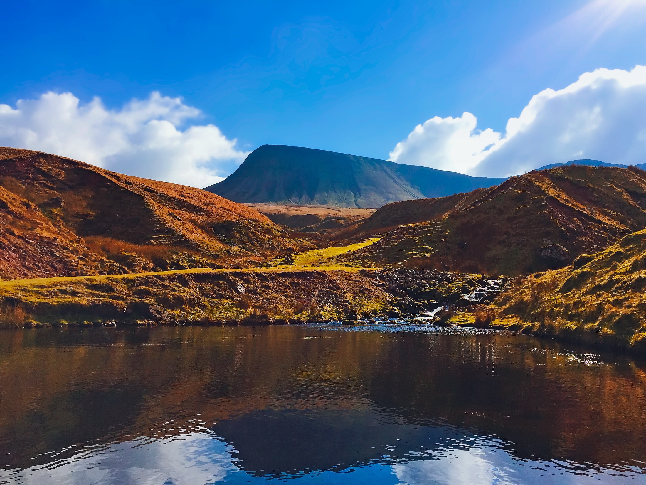
Many people who want to visit Bannau Brycheiniog, the national park still widely known as the Brecon Beacons, assume that a car is essential, yet that is not necessarily the case for walkers and other visitors who do not drive. The park adopted its Welsh name on official signage and literature in April 2023, although the older English name remains in everyday use, so both names appear below.
The reality is more encouraging than many expect, because several railway lines run around the edges of the park even though none crosses its centre. Brecon itself lost its passenger trains when the line closed to passengers on 31st December 1962, so every journey involves a bus or a walk from a station on the fringe.
Four stations stand out as gateways, namely Abergavenny, Merthyr Tydfil, Llandovery and Neath. Stations such as Llandeilo, Ammanford and Ebbw Vale Town serve particular corners of the park, although the onward journey from them needs more planning. Timetables change from time to time, so the operator pages are worth consulting before setting out.
Rail Gateways Around the Park
Abergavenny
As the most useful eastern gateway, the town sits on the Welsh Marches Line between Newport and Hereford. Direct trains run between Manchester Piccadilly and Cardiff Central through the station, which makes it a straightforward arrival point for anyone coming from Manchester or Crewe.
Onward travel starts with the X43, which runs from the bus station to Crickhowell and Brecon and opens up the Usk Valley and the eastern hills. On Saturdays, buses run from early morning until the evening, which leaves plenty of scope for a full day out. Sunday times differ, so they need checking separately.
Merthyr Tydfil
Trains from Cardiff reach the principal southern gateway in about an hour. From the bus station, the T4 continues towards Brecon and stops at Storey Arms, where the main paths into the central Beacons begin. A footpath links the Storey Arms bus stops with the route towards Corn Du, which makes the stop a practical starting point for a day on the hills.
An itinerary that begins at Abergavenny and ends at Merthyr Tydfil, or runs the other way, avoids retracing the same ground. It only works if the walking route and the bus connections at both ends fit the day’s services, so it suits walkers who are happy to plan carefully.
Llandovery and Llandeilo
The Heart of Wales Line between Shrewsbury and Swansea calls at the town, and the scenery from the train is a reward in itself. Trains remain infrequent, although Transport for Wales added a new midday train in each direction from 14th December 2025, which raised the service from four trains a day to five.
Walkers wanting to reach Brecon can continue by bus, because the X80 provides the onward link from Llandovery via Sennybridge, although it runs from Monday to Saturday only. Those heading for the hills beyond, by contrast, can stay on the train as far as Llandeilo, which is the better stop for the western Black Mountain, Carreg Cennen Castle and Dinefwr.
Neath and Waterfall Country
On the South Wales Main Line, the town offers an approach to the southern valleys, Waterfall Country and the T6 bus corridor. Transport for Wales sells combined rail and TrawsCymru tickets for T6 journeys to Ystradgynlais or Brecon with the rail connection at Neath, and its page quotes £18.60 for an Anytime Single between Cardiff and Brecon (prices correct as of January 2026). The operator notes that these tickets can save money compared with some rail-only routes, although combined tickets may not be available to every stop along the route.
The T6 also serves Craig y Nos on its way between Neath and Brecon, but buses to the waterfalls are thinner. Services 55, 161 and 162 run limited timetables, and service 55 is registered for Sundays and bank holidays only.
Other Useful Stations
Ammanford, also on the Heart of Wales Line, gives access to the south-western fringes of the park, although onward transport is limited. The southern and eastern approaches are better reached from Ebbw Vale Town at the end of the Ebbw Valley line or from Pontypool & New Inn on the Marches Line south of Abergavenny, and local buses may be needed from either.
For crossing the border from England, Hereford is another Marches Line gateway, and the X44 links it with Hay-on-Wye, Talgarth and Brecon. For anyone travelling from Manchester or Crewe, changing at Hereford for the X44 gives access to the northern Black Mountains as an alternative to staying on the train to Abergavenny.
Choosing a City as a Base
Cardiff and Swansea both make workable bases for a longer visit, because each offers more rail connections and a wider choice of accommodation than Brecon while keeping different parts of the park within reach. Cardiff is better placed for the central and eastern Beacons, whereas Swansea has the advantage for the western Beacons and the Upper Swansea Valley.
Cardiff
The central Beacons mean a train from the city to Merthyr Tydfil followed by the T4 to Storey Arms, whereas Crickhowell and Table Mountain mean a train to Abergavenny followed by the X43. The same train and bus combination via Merthyr Tydfil reaches Brecon, which leaves time to explore the town.
This base offers a different set of journeys, with the T6 running from the city through Neath and Ystradgynlais to Craig y Nos and Brecon. For the western Beacons, Ystradgynlais in the Upper Swansea Valley and Craig y Nos suit shorter outings from the city. Brecon is better treated as a full-day excursion than as an afternoon outing, so the longer run is best kept for days with an early start and a planned return.
Splitting the Stay
Direct trains between the two cities take an average of 53 minutes, so a stay divided between Cardiff and Swansea is entirely feasible. Four or five nights in each city during a ten-day trip could reduce repeated cross-country journeys while allowing walks in both the eastern and western Beacons.
Bus Services and the Length of the Operating Day
For a day walk, the number of buses is only part of the calculation, because the first departure, the last return and the gaps between services all matter. The patterns below reflect the October 2026 timetables, and times refer to departures from the named starting point rather than every stop along the route.
T4
A reorganisation on 1st September 2025 brought an hourly service between Brecon and Merthyr Tydfil from Monday to Saturday and a bus every two hours between Newtown and Brecon. Sundays began as a two-hourly service with hourly summer enhancements, and from 28th March 2026 Transport for Wales raised Sundays and bank holidays to hourly between Brecon and Merthyr Tydfil. The announcement describes this as a summer boost, so check whether the hourly Sunday pattern continues after October.
T6
Buses between Swansea, Neath, Ystradgynlais and Brecon run hourly for much of the day from Monday to Saturday, which suits a Swansea base best, although Sundays and bank holidays bring a reduced timetable. Transport for Wales adjusted selected afternoon and some evening departures from 31st May 2026, so older printed timetables may no longer apply.
X43
Together with the 43, this route provides approximately hourly journeys between Abergavenny, Crickhowell and Brecon, although the intervals vary from about 45 minutes to an hour and a half because the two numbers serve different villages. Sunday journeys exist too, but their times need checking before a walk is planned around them.
X44
Buses link Hereford, Hay-on-Wye and Brecon roughly every two hours on weekdays, but only a handful of Sunday departures run from Brecon to Hereford. That suits a planned excursion, although it leaves little flexibility for a longer walk.
X80
Services are far less frequent, with four journeys in each direction from Monday to Saturday and no Sunday service. Because of the several-hour gap between the early and late afternoon departures, the return journey needs planning with care.
Smaller Local Services
Minor timetabled routes need more careful checking, and Powys County Council’s list of local routes is the best place to start. Around Brecon the 40A and 40B provide town services, while the 62 and 64 run from Ystradgynlais towards Coelbren and Ammanford, so return times should be checked before setting out.
Numerous Possibilities Shaped by Timetable Limitations
In summary, the national park is a realistic destination for visitors without a car, with Abergavenny, Merthyr Tydfil, Llandovery and Neath offering the most useful rail connections. The absence of a central station means local buses do much of the work, and the T4, T6, X43 and X44 form the main corridors.
The question therefore shifts from whether the trip is possible to which day suits which service, since Sunday timetables and afternoon gaps matter more than headline frequencies. For example, the X43 runs into the evening, yet that does not mean a walker can finish at 19:00 in the Usk Valley, because the last departure from the stop nearest the walk may leave much earlier than the final journey of the day. Checking the exact outward and return journeys before committing to a route therefore remains essential.
From October 25th, Bus Éireann is introducing revised timetables for its Expressway Route 13 and Route 14 services, which operate between Limerick, Tralee and Killarney. The changes aim to improve reliability and punctuality by adjusting departure times according to traffic conditions. A new Sunday morning departure from Tralee to Limerick has been added, and some weekday and Sunday journeys have been withdrawn. Discounted online fares are available until the end of November and customers are encouraged to book tickets in advance to secure their seats.
18:47, October 9th, 2026
The National Transport Authority, in partnership with Clare County Council, has introduced a new Ennis Town Bus Service, which will begin operating on 18th October 2026 as part of the Transport for Ireland network. The service includes two routes, NS1 and NS2, connecting key areas of Ennis such as the town centre, Ennis Hospital, Ennis Bus and Rail Station and surrounding residential areas. Both routes operate every 30 minutes throughout the day, with a 15-minute frequency along a shared central section and run from early morning until late at night.
The buses are low-floor, fully accessible and high capacity. Standard fares apply, with discounts available for Leap card users and free travel for certain groups. This development is part of the NTA’s Town Bus Programme, which seeks to provide sustainable and accessible public transport in regional towns across Ireland.
 Posted on October 12th, 2026