Getting Around Canada Without a Car
![]() Posted on June 8, 2026
Posted on June 8, 2026
![]() Reading time: 13
minutes.
Reading time: 13
minutes.
Reading about travel in Canada a while back raised hopes of managing without a car than similar research into its neighbour to the south. At nearly ten million square kilometres, Canada is the second-largest country in the world by total area, after Russia, and that scale is where the real challenges emerge. Population density thins out sharply west of Ontario, and the Prairie provinces and British Columbia contain enormous distances between communities that public transport is only beginning to bridge. Even so, a surprising range of bus, rail and ferry options exists, and piecing them together into a workable itinerary is a more realistic prospect than the country’s scale might initially suggest.
National Rail
VIA Rail is the national passenger operator and the starting point for any rail-based itinerary in Canada. Its Windsor–Quebec City Corridor is the workhorse of the network and the section where rail most readily competes with other modes, while the long-distance trains, including The Canadian to Vancouver and The Ocean to Halifax, open up journeys where the ride itself is a large part of the point. A fuller account of how the network divides, where it performs well and where freight priority introduces delay is covered in An Introduction to Canadian Train Travel for Independent Travellers. One practical note worth carrying into any planning: corridor services are currently subject to routine delays of between 15 and 45 minutes, and long-distance trains can run considerably later, so building generous margins into any onward connection is strongly advisable.
Looking further ahead, Alto is developing Canada’s first high-speed rail service, connecting Toronto and Quebec City over approximately 1,000 kilometres of dedicated, mainly electrified track at speeds of 300 km/h or more. The route serves Toronto, Peterborough, Ottawa, Montreal, Laval, Trois-Rivières and Quebec City, with the Ottawa–Montreal section announced as the first phase in December 2025. No construction start date has been set, but the project represents the most significant potential change to the Ontario–Quebec travel picture since VIA Rail was established.
Ontario
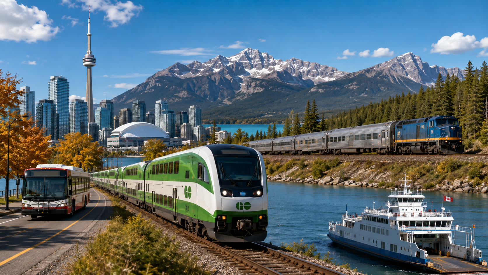
Nowhere is the layering of transport more apparent than in the Greater Toronto and Hamilton area. Arriving by air, the Union Pearson Express is a dedicated rail link covering the 23 kilometres between Toronto Pearson International Airport and Union Station in around 25 minutes, with departures every 15 minutes throughout the day. That same Union Station is where all seven GO Transit commuter rail lines converge, making it the natural hub for anyone continuing outward by regional train. GO Transit, operated by the provincial agency Metrolinx, runs those seven lines and 39 bus routes across 532 kilometres of track and a further 2,776 kilometres of bus network, carrying around 79 million passengers in 2025. The urban layer sits on top of this in the form of the Toronto Transit Commission, whose buses, trams and subway handled over 800 million passenger journeys in the same year, with Triplinx providing a single journey planning portal across both networks.
The outer municipalities each run their own transit systems, handling the local connections that GO Transit does not reach. Brampton Transit, MiWay in Mississauga, Oakville Transit, Burlington Transit, Milton Transit and York Region Transit collectively cover the suburban and lakeshore communities to the west and north of Toronto. Most of these places function as residential extensions of the city, though Burlington has its own waterfront and the Royal Botanical Gardens, Oakville has a well-regarded arts and restaurant scene along Lake Ontario, and Mississauga is where Toronto Pearson International Airport sits, making MiWay relevant for anyone staying outside the city centre and needing to reach the terminal independently of the Union Pearson Express.
Beyond the GTHA, municipal transit covers a wide arc of places that reward a visit in their own right. Grand River Transit serves the Kitchener-Waterloo area, home to two universities and the largest Oktoberfest celebration outside Germany. Hamilton, reached easily from Toronto by GO rail, has reinvented itself around arts and independent food culture, with HSR (Hamilton Street Railway) covering the city locally. Barrie Transit gives access to a city on Lake Simcoe that serves as the main gateway to Ontario’s cottage country. Guelph Transit, Peterborough Transit, Durham Region Transit and Orangeville Transit round out the commuter and smaller-city layer. At the southern end, Niagara Falls Transit and St. Catharines Transit Commission serve one of the most visited areas in Canada, where the falls draw millions of visitors a year and the Niagara Peninsula wine country offers a very different reason to linger.
For longer journeys across the province, Coach Canada and the separately operated Megabus connect Toronto with Ottawa, Montreal, Kingston and Niagara Falls. Where those corridors end, Ontario Northland takes over, with coaches reaching as far north as Hearst and the Polar Bear Express train providing the only link to Moosonee, a subarctic community with no road connection to the south. The planned Northlander rail service between Toronto and Timmins, covering 740 kilometres with 16 stops, will extend that reach further once it enters service. At the eastern end of the province, Ottawa sits on the VIA Rail Windsor–Quebec City corridor and receives GO Transit bus services from Toronto, with OC Transpo running the city’s own buses and light rail.
Quebec
Quebec’s transport divides between the dense commuter network that Exo operates around Montreal, with five rail lines and over 200 bus routes integrating with the Metro and the newer Réseau express métropolitain, and the long coach routes of Orléans Express that carry passengers between Quebec City, Rimouski, Rivière-du-Loup and points beyond. The two serve fundamentally different needs: Exo is a commuter and urban network built around Montreal’s geography, while Orléans Express is the intercity spine for the rest of the province, and understanding which applies to a given journey saves considerable time at the planning stage. Quebec City itself has no suburban rail, though it is well served by both Orléans Express coaches and VIA Rail corridor trains from Montreal. Within the city, Réseau de transport de la Capitale (RTC) operates 182 bus routes covering the wider urban area, including stops at Jean-Lesage International Airport and both the city’s train and coach stations. The old town and most visitor destinations are compact enough to explore on foot, but the RTC is the practical option for reaching the suburbs or the airport, and a development plan running to 2028 is expanding frequency and peripheral coverage across the network.
Alberta and the Prairies
Population density drops noticeably once Ontario gives way to the Prairie provinces, and the coach network becomes correspondingly more important. The largest presence is now FlixBus, the German operator that acquired Greyhound Lines internationally from First Group in 2021 and entered Canada the following year, expanding steadily to cover Ontario, Quebec, Alberta, Saskatchewan and Manitoba as well as cross-border US routes that also serve Vancouver. On the Alberta corridors between Calgary, Edmonton and Fort McMurray, Red Arrow has operated since 1979 and built a reputation for punctuality and a level of comfort that sets it apart from standard coach travel, with reclining seats, complimentary snacks and Wi-Fi on all routes. Its sister service Ebus, under the same Keolis ownership but with a no-frills approach, extends into British Columbia and since October 2025 has run a through service linking Vancouver and Calgary via the mountain communities of Revelstoke, Golden, Lake Louise, Banff and Canmore. At the other end of the spectrum entirely, the Keewatin Railway Company operates a twice-weekly mixed service between The Pas and Pukatawagan in northern Manitoba, a First Nations-owned railway line where the train remains the only realistic link for communities with no road alternative.
For travellers flying into Calgary International Airport, the options divide between those heading into the city and those heading straight into the mountains. The most affordable city connection is Calgary Transit’s BRT Route 300, which runs from the terminals to downtown along Centre Street in around 55 minutes for a standard fare of CAD 3.80, a surcharge having been abolished in 2023. Once in the city, Calgary Transit’s CTrain light rail gives access to much of the urban area, with two lines covering 59.9 kilometres and 45 stations and annual ridership of around 93 million trips in 2025. For the mountains, Banff Airporter has run eleven daily departures to Canmore and Banff since 1997, and Airport Shuttle Express extends the reach further, covering Canmore, Banff, Lake Louise and Jasper for those whose destination lies beyond the Banff Airporter’s range.
Once in the Bow Valley, Roam Transit connects Banff, Canmore and Lake Louise across 14 routes, seven of which run year-round. Annual ridership reached nearly two million in 2025 and is growing fast enough that the service is on course to hit three million well ahead of its 2030 target, with summer routes in Banff regularly running at capacity. Several hotels in Banff include free passes for guests on local routes, and those staying at campsites on Tunnel Mountain and Two Jack Lake are encouraged to leave their vehicles on site and ride into town without charge. For a national park where road congestion is a genuine constraint, Roam Transit has become a meaningful part of how both visitors and residents move around, and it makes car-free movement within the valley considerably more practical than the shuttle journey from Calgary alone might suggest.
Further north, Jasper Transit provides a municipal shuttle connecting the town with Whistlers and Wapiti campsite, Pyramid Lake Lodge, Jasper Park Lodge and Lake Annette. For Maligne Lake, which sits 44 kilometres south of Jasper town at the start of the Skyline Trail, Maligne Adventures runs both a return day-visitor shuttle from Jasper and a one-way hiker’s service between trailheads for those walking the Skyline Trail. Maligne Canyon, which lies on the same road, was closed through the 2025 to 2026 season due to damage from the 2024 Jasper Wildfire and its status should be confirmed before travel.
Edmonton is served by Edmonton Transit Service (ETS), which operates 181 bus routes alongside three LRT lines with 29 stations. Annual ridership exceeded 100 million in 2024, and the Valley Line West LRT extension was under construction in 2025, adding further coverage to the west of the city. Further east, Winnipeg Transit carries around 61 million passengers a year across 71 routes, with a substantially redesigned Primary Transit Network launched in June 2025 that reorganised services around a more frequent core and added connections to areas previously poorly served. Saskatoon Transit is more modest in scale but covers the main urban corridors of a city that sits on the South Saskatchewan River and is home to the University of Saskatchewan. A Link BRT system is planned to launch in 2028, which will significantly improve east-west and north-south connections across the city.
Alberta’s Passenger Rail Master Plan, completed in summer 2025 with government decisions on investment following in 2026, sets out a long-term vision for passenger rail across the province. The plan includes a high speed rail line between Calgary and Edmonton via Red Deer, rail connections from both cities to their international airports, and regional lines linking Calgary and Edmonton to the Rocky Mountain parks. A Crown corporation is proposed to develop the infrastructure and oversee operations, with the existing CTrain and Edmonton LRT systems forming the urban foundations on which the provincial network would build. The Calgary–Banff connection is the element most directly relevant to car-free mountain travel and, if delivered, would represent a qualitative change to what is currently possible on that corridor. Government decisions on the timeline and pace of investment are expected through 2026, so the plan remains at an early stage despite the ambition of its scope.
British Columbia
Cross the Rockies and the picture shifts to a pair of complementary networks. TransLink serves Metro Vancouver with bus, SkyTrain rapid transit, the SeaBus ferry across Burrard Inlet and the West Coast Express commuter rail service, with roughly one third of the region’s population using it each week. Its 2025 investment plan delivered the largest increase in bus service since 2018, adding frequency on 50 routes and launching 40 new or improved services. Beyond the metropolitan area, BC Transit covers the rest of the province from Victoria and Kelowna to Prince George and Whistler, and in many of those communities it is the only public transport available.
Arrivals into Vancouver International Airport are well served by public transport, beginning with the Canada Line SkyTrain, which runs directly from YVR to Waterfront Station in 26 minutes with trains every six to ten minutes. An airport surcharge applies on top of the standard zone fare, and as of January 2026 the N10 NightBus fills the overnight gap when the Canada Line is not running. For those heading to Whistler or Squamish, the choice is between YVR Skylynx, which departs from the terminal itself with up to fourteen daily coaches via Squamish and Creekside Village, and Epic Rides, which has operated from Burrard SkyTrain station in downtown Vancouver since 2012 and now carries over 200,000 passengers a year on the same corridor. The two complement each other rather than simply duplicate: Skylynx suits those arriving at the airport, while Epic Rides is the more practical choice for anyone already in the city. Skylynx also runs a Victoria service via Tsawwassen, connecting with the BC Ferries crossing to Swartz Bay on Vancouver Island.
Atlantic Canada
Atlantic Canada requires a different kind of planning, one in which ferry crossings are not incidental but structurally necessary. The crossing that matters most is the Marine Atlantic service between North Sydney, Nova Scotia, and Port aux Basques, Newfoundland and Labrador, which runs daily year-round and takes around six hours, with a seasonal extension to Argentia from June to September. Without it, the island of Newfoundland is unreachable by surface transport. On the island itself, Metrobus covers St. John’s and DRL provides inter-community coach services, while Maritime Bus handles connections across the Maritime provinces on the mainland. The Newfoundland & Labrador Local Transportation pages give a broader picture of what is available across the province as a whole.
Halifax is the largest city in Atlantic Canada and the natural base for exploring Nova Scotia. Halifax Transit runs around 65 bus routes alongside five ferry services linking Halifax and Dartmouth across the harbour, carrying around 30 million passengers a year. It is one of the more complete urban transit systems in the region, with routes reaching the airport and most visitor destinations within the municipality. New Brunswick’s three main cities each have their own bus networks: Moncton, Saint John and Fredericton all received federal funding in early 2025 to expand and modernise their fleets, though service frequencies in all three remain modest by larger-city standards and a car will open up considerably more of the province.
Travelling Car-Free Across Canada
Canada is large enough that the first and most important planning decision is not which services to use but how much ground to cover. Trying to see the country from coast to coast in a single trip is a different proposition from choosing one region, understanding its network thoroughly and moving through it at a realistic pace. The Corridor cities of Ontario and Quebec, the metropolitan areas of Vancouver and Calgary, and the Atlantic provinces each offer genuine car-free possibilities, but they are not easily combined into a single itinerary without either very long journey times or the kind of gaps in service that make connections unreliable. Picking one and doing it properly tends to produce a more satisfying trip than attempting to stitch together several regions under pressure of time.
Within a well-chosen scope, the network makes considerably more possible than Canada’s scale might initially suggest. Urban transit in Toronto, Montreal, Vancouver, Calgary and Edmonton is substantial, intercity coaches now cover most of the main corridors between them, and VIA Rail provides the long-distance spine where it operates. The places where the network genuinely thins out are the rural and northern areas beyond the reach of any of these systems, and knowing where those limits lie before departure is as useful as knowing what the services themselves can do.
Recent Musings
Getting Around Canada Without a Car
From Navan to Belfast, Irish Rail Improvements Continue to Take Shape
How Iarnród Éireann's Investment Programme Is Reshaping the Rail Network Across Ireland
Integrated Rural Transport Coming to Derbyshire
Extras & Utilities
Carrying Bicycles on Buses in Britain and Ireland
Not Just Blogs, A Collection of Public Transport News Sources